Eruption Day 2:
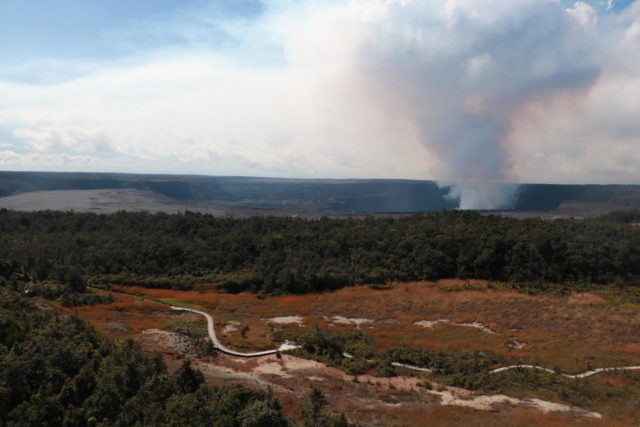
Halema‘uma‘u Crater Filling With Lava
The following press release is from the USGS Hawaii Volcanoes Observatory. All images are in the public domain from the USGS/HVO.
PRESS RELEASE
Hawaii Files Volcano Watch Page (link)
HAWAIIAN VOLCANO OBSERVATORY DAILY UPDATE
U.S. Geological Survey
Tuesday, December 22, 2020, 11:51 AM HST (Tuesday, December 22, 2020, 21:51 UTC)
KILAUEA VOLCANO (VNUM #332010)
19°25’16” N 155°17’13” W, Summit Elevation 4091 ft (1247 m)
Current Volcano Alert Level: WATCH
Current Aviation Color Code: ORANGE
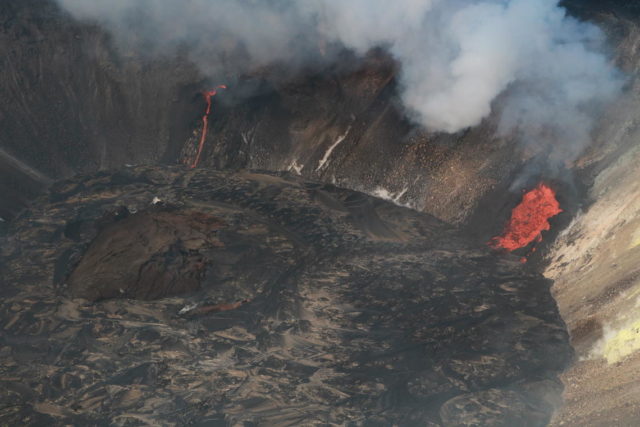
Activity Summary: No significant change. Kīlauea continues to erupt at its summit from at least two vents on the north and west sides of Halemaʻumaʻu. As of this morning, the growing crater lake was 487 m (1,598 ft) below the crater rim, indicating that the lake has filled 134 m (440 ft) of the bottom of the Halemaʻumaʻu crater
Summit Observations: Summit tiltmeters continued to record slowing deflationary tilt through this morning. Sulfur dioxide emission rates remain high estimated at around 30,000 tonnes/day. Seismicity is elevated but stable the last day, with few earthquakes and tremor fluctuations related to the vigor of fissure fountaining.
Halemaʻumaʻu lava lake observations: When measured last night, the Halemaʻumaʻu lava lake was 487 m (1,598 ft) below the crater rim and rising at more than 1 m/hr (3 ft/hr). Of the three vents that initially erupted from the north and northeast walls of Halemaʻumaʻu, only two remain active, with the middle vent pausing eruptive activity between approximately 7:30 and 8:00 a.m. HST. The middle and west vents, which are located on the lowest down-dropped block within Halemaʻumaʻu crater, have since been inundated by the growing lava lake. The farthest east vent remains the most vigorous.
As of early this morning, a preliminary calculation of volume suggests that, since the start of the eruption, approximately 10 million cubic meters of lava have been erupted (equivalent to over 2 billion gallons). This is a surface area of about 33 acres.
Webcam views of the lava lake can be found here: https://volcanoes.usgs.gov/volcanoes/kilauea/multimedia_webcams.html.
Hazard Analysis: High levels of volcanic gas, rockfalls, explosions, and volcanic glass particles are the primary hazards of concern regarding this new activity at Kīlauea’s summit. Large amounts of volcanic gas—primarily water vapor (H2O), carbon dioxide (CO2), and sulfur dioxide (SO2)—are continuously released during eruptions of Kīlauea Volcano. As SO2 is released from the summit during this new eruption, it will react in the atmosphere with oxygen, sunlight, moisture, and other gases and particles, and within hours to days, convert to fine particles. The particles scatter sunlight and cause the visible haze that has been observed downwind of Kīlauea, known as vog (volcanic smog), during previous summit eruptions. Vog creates the potential for airborne health hazards to residents and visitors, damages agricultural crops and other plants, and affects livestock operations. Rockfalls and minor explosions, such as the ones that occurred during the 2008–2018 lava lake eruption at Kīlauea summit, may occur suddenly and without warning. This underscores the extremely hazardous nature of Kīlauea caldera rim surrounding Halemaʻumaʻu crater, an area that has been closed to the public since late 2007. Pele’s hair and other lightweight volcanic glass fragments from the lava fountains within Halemaʻumaʻu will fall downwind of the fissure vents and lava lake, dusting the ground within a few hundred meters (yards) of the vent. High winds may waft lighter particles to greater distances. Residents are urged to minimize exposure to these volcanic particles, which can cause skin and eye irritation similar to volcanic ash.
Please see this Hawaii Volcanoes National Park Press Release “How to Safely View the New Eruption in Hawaiʻi Volcanoes National Park” at https://www.nps.gov/havo/learn/news/20201221_nr_new-summit-eruption-kilauea.htm.
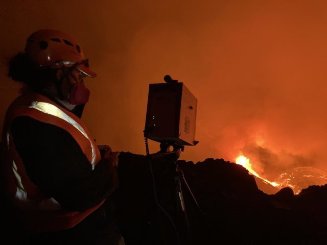
The Hawaiian Volcano Observatory (HVO) continues to closely monitor Kīlauea’s seismicity, deformation, and gas emissions for any sign of reactivation, and maintains visual surveillance of the summit and the East Rift Zone. HVO will continue to issue daily updates and additional messages as needed.